
Opis
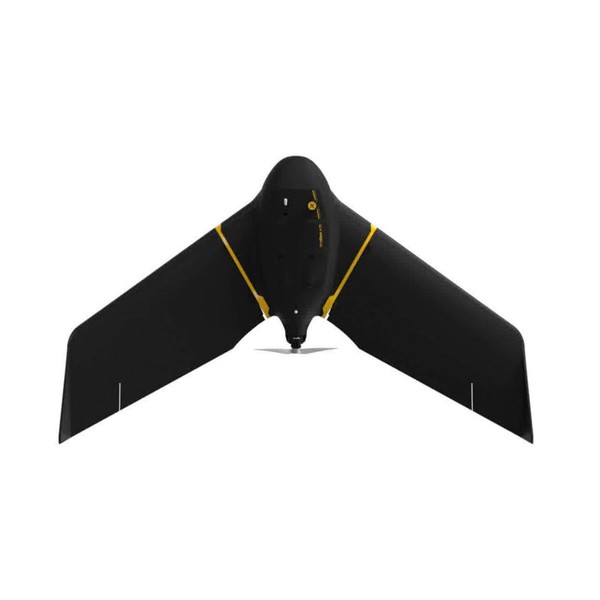
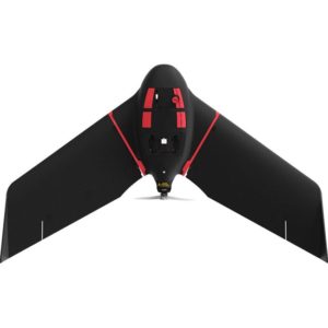
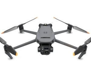
Lightweight mapping drone for large coverage and sharp data
eBee X offers 90-minute flights, RTK, PPK, online training, eMotion flight planning software, and more.
Perform professional mapping operations, including flying safely over people and BVLOS, with the NDAA-compliant eBee X drone.
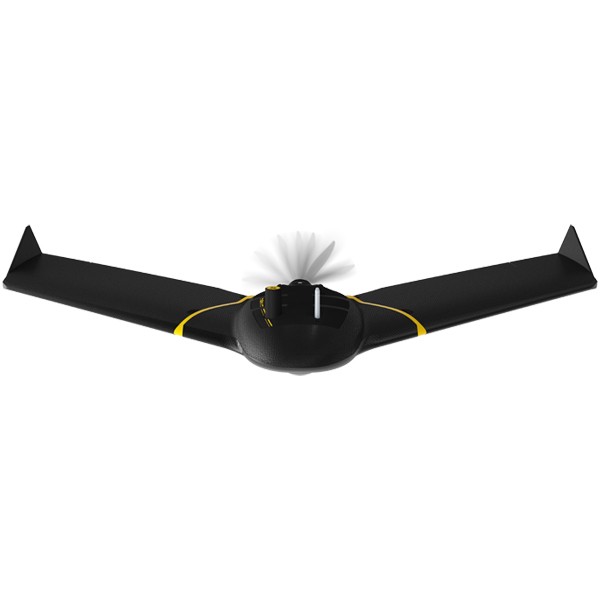
Fly, map and process. That easy.
Features
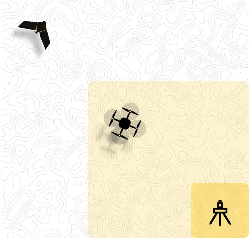
Map smarter and safer
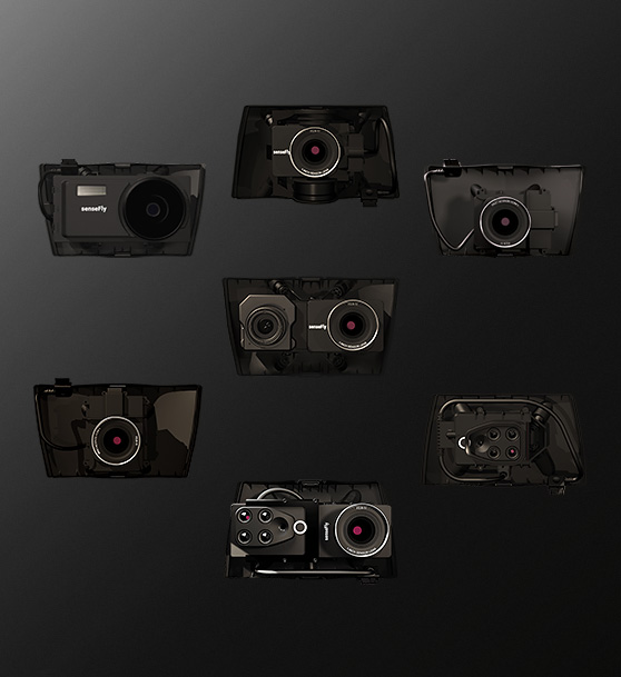
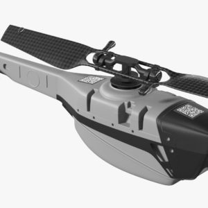
3D, RGB, multispectral and thermal cameras
eBee X is compatible with a wide range of interchangeable photogrammetry cameras that capture reliable aerial imagery – from 3D models to orthomosaics – to suit every mapping job.
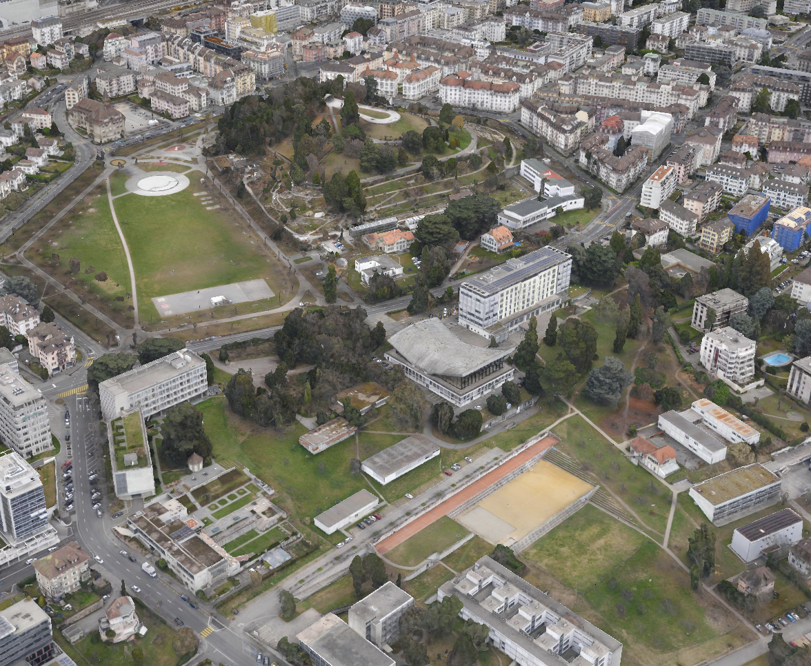
1.5 cm / 0.6 in absolute accuracy
With the on-demand RTK / PPK capabilities of survey drone eBee X, you can gather data without ground control points (GCPs) while maintaining a GSD down to 1.5 cm / 0.6 in.

1.6 kg / 3.6 lbs takeoff weight
Operate safely within more regulatory frameworks thanks to the eBee X’s light weight, which extends your operational possibilities – BVLOS and flights over people – and range.
eBee X has the best ratio energy / MTOW compared to heavier VTOLs.
90 minutes flight time
Efficiently map up to 500 ha / 1,235 ac while flying at 120 m / 400 ft eBee X flight time of up to 90 min* makes it the perfect drone for covering large areas.
*With endurance battery and S.O.D.A. camera.
RTK / PPK available
RTK and PPK allow you to ensure more reliability with the accuracy obtained, without ground control points. The eBee X professional drone is compatible with the industry’s leading base stations.
Shock absorbent
Our R&D engineers have designed a shock absorbent drone fuselage with an underbelly made of reinforced polypropylene woven mesh.
Remote ID, C2 and C6
We’ve prepared for U.S. and European drone regulations with eBee X, featuring built-in FAA-approved Remote ID and EU C2 and C6 labeling.
Why eBee X
Regulatory advantages
eBee X operators benefit from regulation advantages not available to heavier drones above 2 kg / 4.4 lbs.
Advanced
operations
The eBee X surveying drone meets the highest possible quality and ground risk safety standards, and thanks to its lightweight design, the effects of ground impact are reduced.

BVLOS approved
- eBee X granted Beyond Visual Line of Sight (BVLOS) operations permission in Brazil.
- eBee X achieved the European C6 marking, for BVLOS within the STS-02 Standard Scenario.
Flights Over People
- eBee X approved to run Operations Over People (OOP) in Canada and United States, essential for city mapping and cadastral surveying.
- eBee X Remote ID approved by the FAA.
SORA process
- eBee X first drone to receive M2 Mitigation Design Verification for SORA process from EASA, essential for BVLOS and OOP authorization in the European Union, Australia, and New Zealand.
Safety as a priority
Successful impact tests to demonstrate operational safety around people.
Free from hard front plastic parts and rear-facing motor.
Flight planning software integrates fail-safe protocols and live air traffic.
Why eBee X
Increase the quality, efficiency and safety of your data collection
Easy to use
The eBee X and its eMotion flight planning software are beginner-friendly, yet packed with advanced features to tackle the toughest jobs. Definitely a smarter way to map.
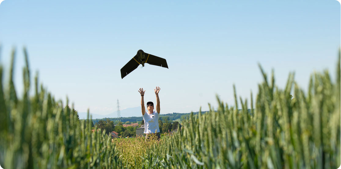
Easy hand-launch
Designed to restart the mission as soon as the drone lands and to be simply hand-launched.
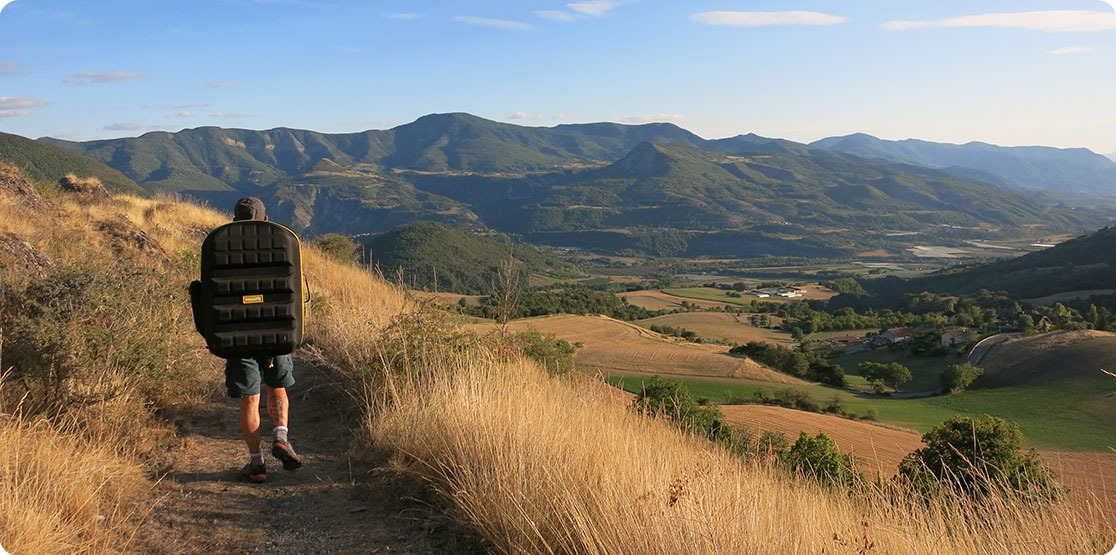
3 minutes deploy
Operated by one user and easily transported in a backpack with all your gear in one spot.
Automated flight
Automated flight and landing with eMotion mission planning software, which is included.
Proven reliability
eBee fixed-wing drones are proven for their unmatched operational safety and ability to deliver high-quality data, from simple to complex missions.
The U.S. Federal Aviation Administration (FAA) drone registration data from 2016 to 2021 confirms that the eBee is the most used fixed-wing drone in the United States.
500,000 +
Flight hours
1,000,000 +
Successful flights
Preflight checks
Automated quick self-diagnosis before every flight
12 years
Industry experience
Why eBee X
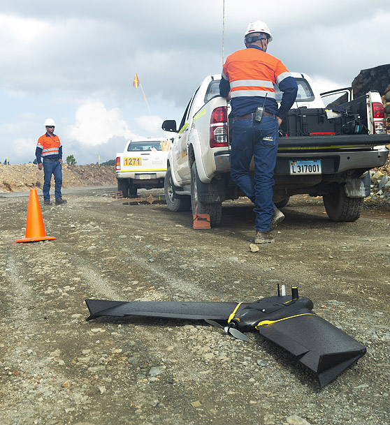
Less time spent on site
Efficiency is crucial for every mapping project. By using the eBee X aerial photogrammetry drone, you can get the precision you need in a fraction of the required time compared to terrestrial methods or other drones, such as quadcopters.

eBee X drone
500 ha / 1,235 ac*
2.9 cm / 1.14 in per pixel
* with senseFly S.O.D.A. 3D nadir imagery

Multicopter drones
Up to 40 ha / 99 ac
3.6 cm / 1.41 in per pixel

Terrestrial tools
8 ha / 19 ac
Field-ready
Safely store and transport everything you need to operate your eBee X in the included backpack.
The ergonomic drone backpack comes with a rain cover and a laptop pocket. It weighs 4.6 kg / 10 lbs empty and 10 kg / 22 lbs when fully loaded.
In the field
Operate in harsh terrain
The eBee X is designed for continuous belly landings without damaging the drone.
Our R&D engineers have created a shock absorbent construction UAS with an underbelly made of reinforced polypropylene woven mesh, able to operate in harsh terrain.
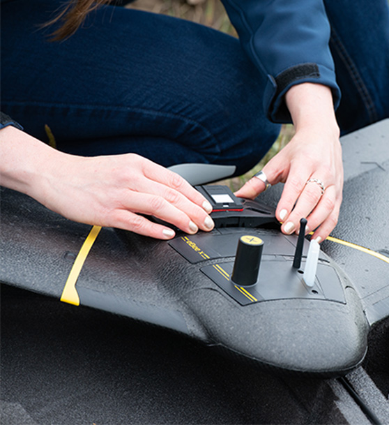
Modular design
Reduce downtime and maintenance costs
eBee X’s modular design reduces both delays and repairs.
Swap out accessories or make in-field repairs with ease, minimizing downtime.
Maintenance is also easy thanks to our global network of authorized service centers, where you can get your eBee X professional drone serviced locally.
At the office
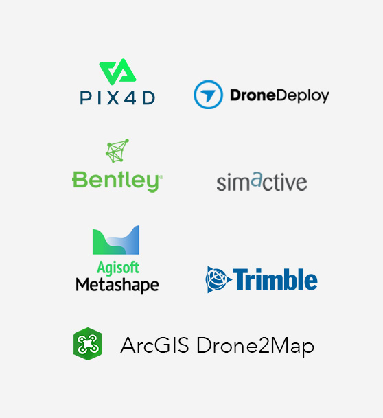
Compatible with most processing software
The eBee X fixed-wing drone data is compatible with:
PIX4Dmapper, PIX4Dmatic, PIX4Dcloud, PIX4Dreact, PIX4Dfields, PIX4Dsurvey, Agisoft Metashape, DroneDeploy, Bentley ContextCapture, SimActive, Esri ArcGIS Drone2Map and Trimble Business Center.
Increase ROI
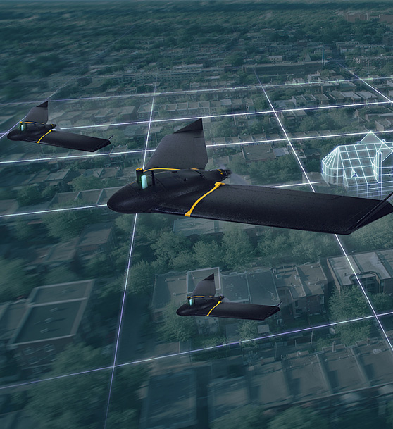
Fly multiple eBees simultaneously
eMotion drone flight management software supports up to 4 eBees mapping simultaneously from the same ground station.
Multi-drone flights increase the efficiency of time-sensitive missions, advanced operations, quick situation assessment, data integrity preservation and daily business activities.
Opinie
Na razie nie ma opinii o produkcie.